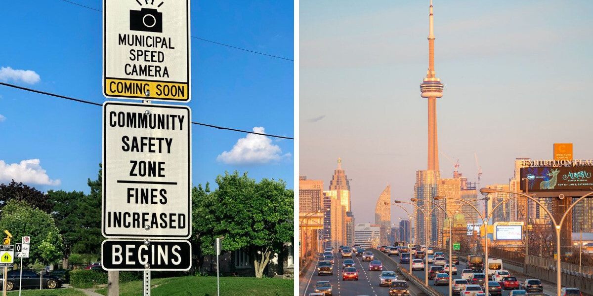
If you drive in Toronto, you know it’s nice to be prepared for what awaits you out on the road, and that includes knowing where the speed cameras in Toronto are — and just how much a fine might cost you if you’re caught going a bit too fast.
In 2020, the City of Toronto began using automated speed enforcement (ASE) cameras all over the city in “community safety zones” — typically areas near schools and places with vulnerable road users like pedestrians and cyclists — with the goal of improving safety and reducing speeding across the city.
Toronto speed cameras work by capturing images of vehicles that exceed the posted speed limits and issuing the registered owners a ticket by mail. If you’re caught speeding, the fine could be hefty, with the maximum fine upwards of $700, depending on how fast you’re going.
But here’s the kicker: No matter who’s behind the wheel, the ticket goes to the registered owner of the vehicle, which means you could get a fine in the mail even if someone else was driving your car. Thankfully, for that reason, no demerit points are issued for ASE tickets and your driving record won’t be impacted.
A study conducted over the first two years of the program revealed an overall 45% reduction in the proportion of people speeding and an overall speed decrease of around 7 km/h in areas with an active speed camera. According to the City, the ASE program issued over 276,000 speeding tickets in the first half of 2024 alone.
Toronto uses a data-driven approach to decide where these cameras go, based on things like traffic volume and past collisions. There are currently 75 speed cameras across the city, with three in each of Toronto’s 25 wards.
The locations rotate every few months, so if you’re wondering where they are currently, you can find a list of all the current speed camera spots in Toronto below. Keep these in mind next time you hit the road!
Where are the speed cameras in Toronto?
Toronto & East York:
- Parkside Dr. south of Algonquin Ave.
- Jane St. near Weatherell St.
- Priscilla Ave. south of Dundas St. W.
- Concord Ave. north of College St.
- Dufferin St. near Waterloo Ave.
- Lansdowne Ave. south of Whytock Ave.
- Brant St. south of Adelaide St. W.
- Richmond St. W. west of Bathurst St.
- D’Arcy St. west of Beverley St.
- Davenport Rd. near McAlpine St.
- Clinton St. north of College St.
- Bathurst St. near Ardmore Rd.
- Arlington Ave. south of Durham Ave.
- Ava Rd. east of Westover Hill Rd.
- Jarvis St. near Cawthra Sq.
- Parliament St. north of Oak St.
- Queen St. E. near Sackville St.
- Danforth Ave. west of Cambridge Ave.
- Broadview Ave. north of Kintyre Ave.
- Strathcona Ave. west of Blake St.
- Dundas St. W. near Carlyle St.
- Kingston Rd. near Heyworth Cres.
- Secord Ave. near Palmer Ave.
- Spruce Hill Rd. north of Queen St. E.
North York:
- Elder St. near Kennard Ave.
- Wilmington Ave. south of Finch Ave. W.
- Bathurst St. north of Finch Ave. W.
- Bathurst St. near Hillmount Ave.
- Lawrence Ave. W. near Chicoutimi Ave.
- Neptune Dr. west of Hotspur Rd.
- Rolph Rd. north of Southvale Dr.
- Leslie St. north of Overland Dr.
- Banbury Rd. near Portsmith Rd.
- The Donway E. north of Greenland Rd.
- Underhill Dr. north of Roanoke Rd.
- York Mills Rd. east of Ness Dr.
- Victoria Park Ave. north of Old Sheppard Ave.
- Cherokee Blvd. south of Pinto Dr.
- Cliffwood Rd. east of Don Mills Rd.
- Hollywood Ave. east of Estelle Ave.
- Senlac Rd. south of Horsham Ave.
- Patricia Ave. west of Homewood Ave.
Etobicoke:
- John Garland Blvd. near 245 John Garland Blvd.
- Gihon Spring Dr. east of Mount Olive Dr.
- Cabernet Circle near 5 Cabernet Circle
- Islington Ave. south of Eglinton Ave. W.
- Rathburn Rd. east of Kipling Ave.
- Burnhamthorpe Rd. west of Echo Valley Rd.
- Royal York Rd. south of Oakfield Dr.
- The East Mall south of Faludon Court
- Horner Ave. near Orianna Dr.
- Keele St. south of Clearview Heights
- Rockcliffe Blvd. near Rockcliffe Court
- Culford Rd. north of Burr Ave.
- Sentinel Rd. south of Derrydown Rd.
- Oakdale Rd. south of Finch Ave. W.
- Shoreham Dr. east of Shoreham Court
Scarborough:
- St. Clair Ave. E. east of Warden Ave.
- Danforth Rd. west of Linden Ave.
- Corvette Ave. west of Brenda Cres.
- Pharmacy Ave. near Princeway Dr.
- Ionview Rd. south of Yorkshire Rd.
- Ellesmere Rd. west of Mondeo Dr.
- Birchmount Rd. south of Huntingwood Dr.
- Finch Ave. E. west of Birchmount Rd.
- Warden Ave. south of Glen Springs Dr.
- McCowan Rd. south of Sandhurst Circle
- Washburn Way north of Berner Trail
- Neilson Rd. north of Finch Ave. E.
- Scarborough Golf Club Rd. north of Lawrence Ave. E.
- Guildwood Pkwy. near Schubert Dr.
- Highcastle Rd. north of Pineslope Cres.
- Canmore Blvd. west of Halfmoon Sq.
- Meadowvale Rd. north of Lawrence Ave. E.
- Charlottetown Blvd. north of McCulley St.
This article’s right-hand cover image was used for illustrative purposes only.
Love this? Check out our Narcity noticeboard for details on jobs, benefits, travel info and more!
AI tools may have been used to support the creation or distribution of this content; however, it has been carefully edited and fact-checked by a member of Narcity’s Editorial team. For more information on our use of AI, please visit our Editorial Standards page.